The Old Maps of the 1800s
Home
Antique Maps
About
Contact
Home
Antique Maps
About
Contact
Canada
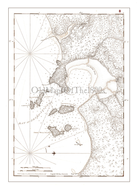
Bay of Seven Islands, Canada in 1778 - Vintage Map, Antique Map, Reproduction, Framable Map, Fine Art, wall map. St. Lawrence, navigation
$35.00 - $85.00
$35.00 - $85.00
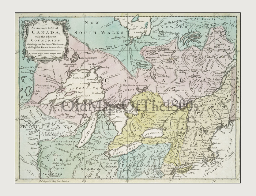
Canada with the Adjacent Countries in 1761 - Vintage, Antique, Reproduction, Framable, Fine Art, wall art
$35.00 - $95.00
$35.00 - $95.00
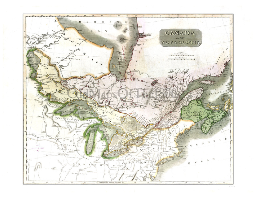
Canada and Nova Scotia in 1817 - Vintage map, Antique map, Reproduction, Framable map, Fine Art, wall map, Great Lakes, Hudson Bay, Asia!
$35.00 - $90.00
$35.00 - $90.00
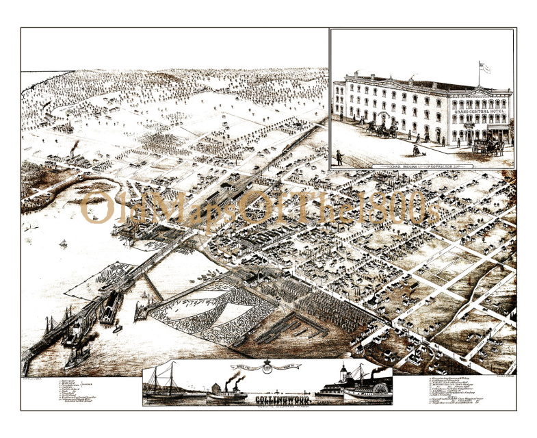
Collingwood, Ontario in 1875 - Bird's Eye View, Aerial, Panorama, Vintage, Antique, Reproduction, Giclée, Framable, Fine Art, home, wall art
$35.00 - $90.00
$35.00 - $90.00
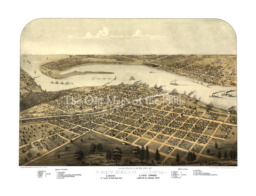
Port Huron, Sarnia, and Gratiot, Michigan and Point Edwards, Canada in 1867- Bird's Eye View Map, Vintage, Antique, Fine Art, Wall Art
$35.00 - $95.00
$35.00 - $95.00
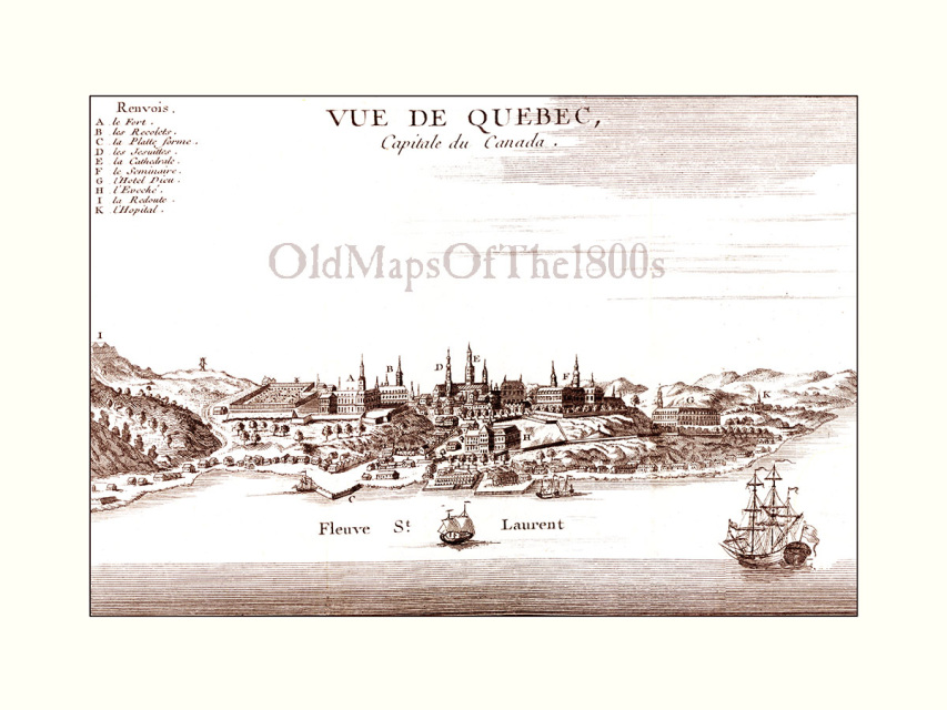
Quebec City in 1755 - Bird's Eye View, Aerial, Panorama, Vintage, Antique, Reproduction, Giclée, Fine Art, Home Decor, Wall Art, History
$30.00 - $95.00
$30.00 - $95.00
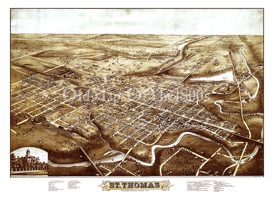
St. Thomas, Ontario in 1875 - Bird's Eye View, Aerial, Panorama, Vintage, Antique, Reproduction, Giclée, Framable, Fine Art, home, wall art
$35.00 - $95.00
$35.00 - $95.00