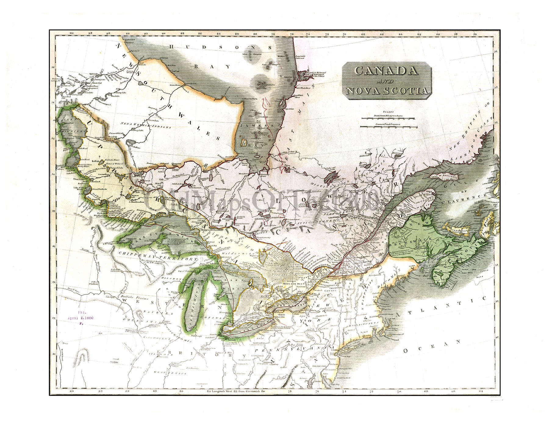
Canada and Nova Scotia in 1817 - Vintage map, Antique map, Reproduction, Framable map, Fine Art, wall map, Great Lakes, Hudson Bay, Asia!
SKU:
$35.00
$35.00 - $90.00
per item
Colored map of Canada and Nova Scotia in 1817, with parts of the United States and a small part of Aisa (you can see it from the deck!). This would make a great teaching tool hanging on a classroom wall ... a wonderful map. Fine detail is remarkable, considering the age of the map.
Printed on heavy duty, premium archival matte paper.
Now also available as a Canvas Gallery Wrap!
Your print will not have the "OldMapsOfThe1800s" watermark.
NOTE: We can print smaller than what is listed, but any text will be hard to read; though it still will make a cool piece of art for your wall. If you would like a smaller size, just contact me and I will put up a listing at your desired size and send you a link to that item. LARGER SIZES THAN WHAT IS LISTED MAY ALSO BE AVAILABLE (depending on the map); contact me with your special request and I will do all I can to accommodate you.