The Old Maps of the 1800s
Home
Antique Maps
About
Contact
Home
Antique Maps
About
Contact
Kentucky
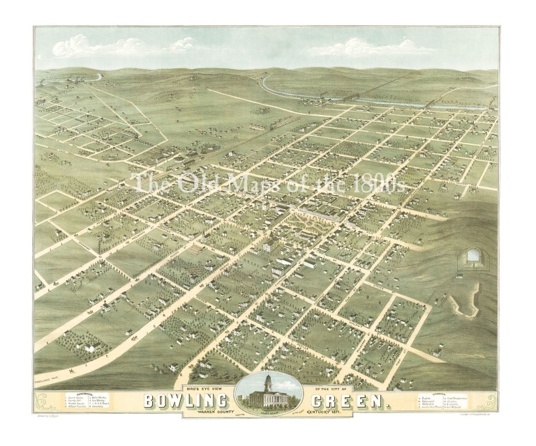
Bowling Green, Kentucky in 1871 - Bird's Eye View Map, Aerial Map, Panorama, Vintage map, Antique map, Reproduction, Fine Art, Wall Art
$35.00 - $90.00
$35.00 - $90.00
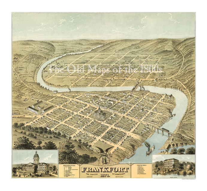
Frankfort, Kentucky in 1871 - Bird's Eye View Map, Aerial, Panorama, Vintage, Antique, Reproduction, Giclée, Fine Art, Wall Art, History
$35.00 - $85.00
$35.00 - $85.00
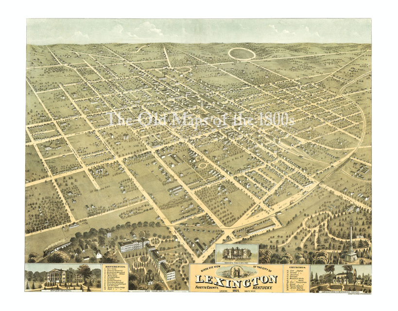
Lexington, Kentucky in 1871 - Bird's Eye View Map, Aerial Map, Panorama, Vintage map, Antique map, Reproduction, Giclée, Fine Art, Wall Art
$35.00 - $90.00
$35.00 - $90.00
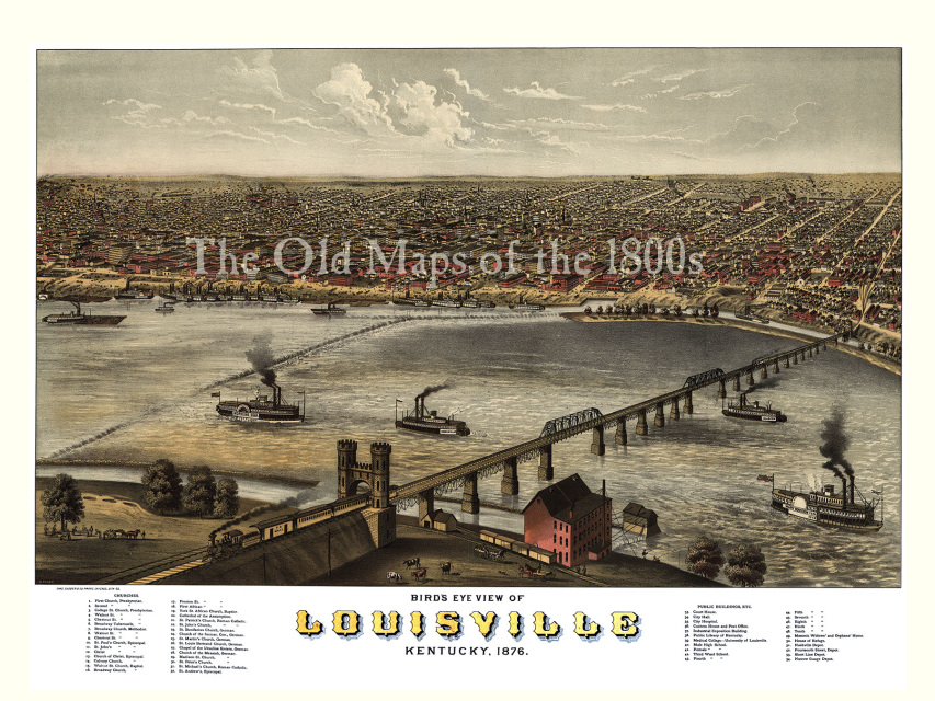
Louisville, Kentucky in 1876 - Bird's Eye View Map, Aerial Map, Panorama, Vintage Map, Antique Map, Reproduction, Giclée, Fine Art, Wall Map
$35.00 - $95.00
$35.00 - $95.00
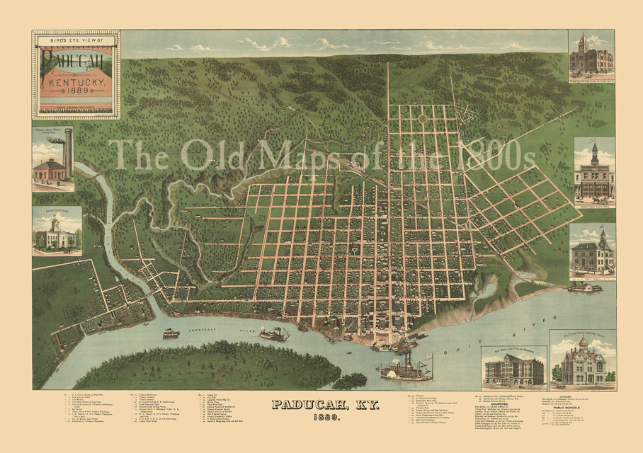
Paducah, Kentucky in 1879 - Bird's Eye View Map, Aerial Map, Panorama, Vintage Map, Antique map, Reproduction, Giclée, Fine Art, Wall Art
$40.00 - $350.00
$40.00 - $350.00
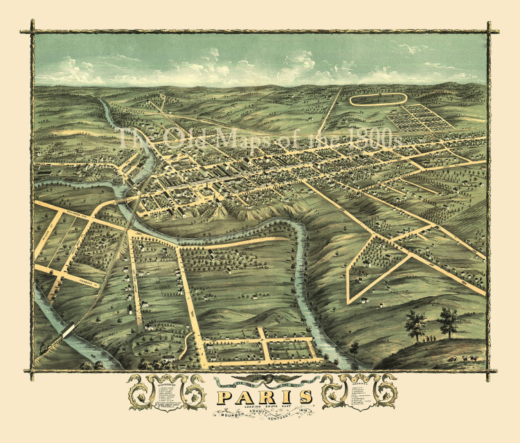
Paris, Kentucky in 1870 - Bird's Eye View Map, Aerial Map, Panorama, Vintage map, Antique map, Reproduction, Fine Art, Wall Art
$35.00 - $90.00
$35.00 - $90.00