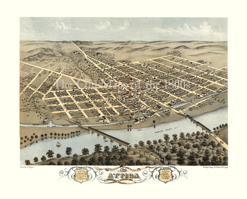
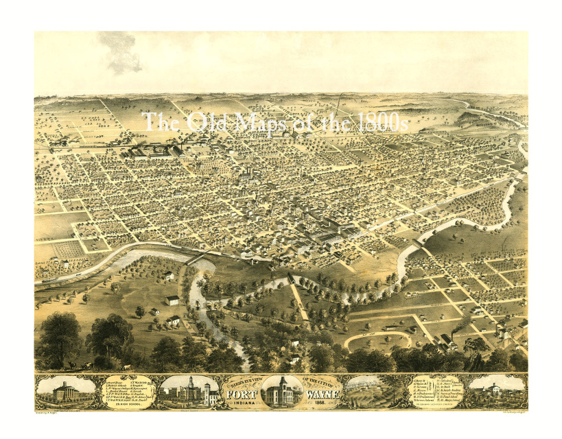
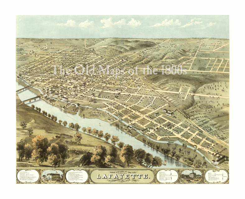
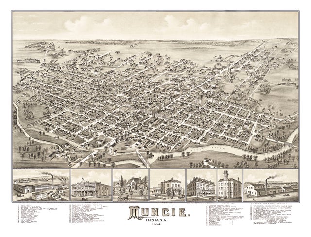
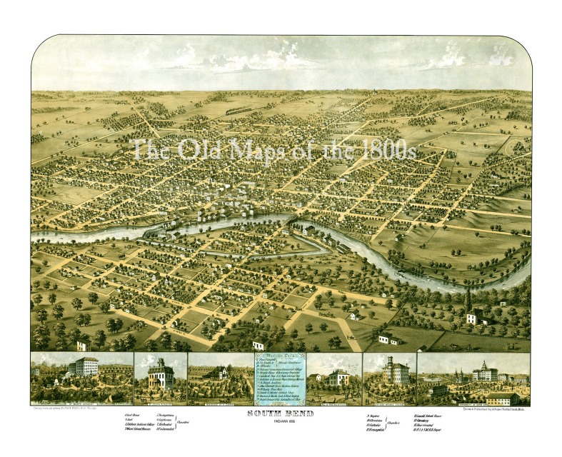
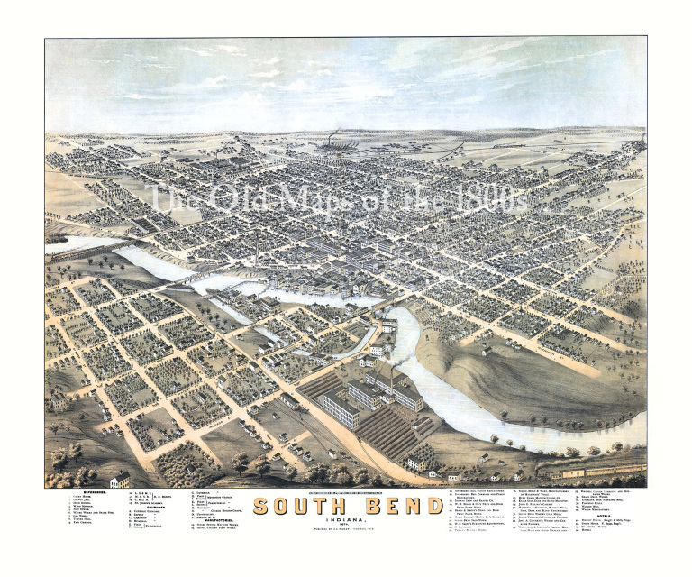
The Old Maps of the 1800s
  • Home
  • Antique Maps
  • About
  • Contact
  • Home
  • Antique Maps
  • About
  • Contact

Indiana

Attica, Indiana in 1869 - Bird's Eye View Map, Aerial Map, Panorama, Vintage map, Antique map, Reproduction, Giclée, Framable map, Fine Art
$35.00 - $90.00
$35.00 - $90.00
Fort Wayne, Indiana in 1868 - Bird's Eye View Map, Aerial Map, Panorama, Vintage map, Antique map, Reproduction, Giclée, Fine Art, Wall Art
$35.00 - $90.00
$35.00 - $90.00
Lafayette, Indiana in 1868 - Bird's Eye View Map, Aerial, Panorama, Vintage, Antique, Reproduction, Giclée, Fine Art, Wall Art, History
$35.00 - $90.00
$35.00 - $90.00
Muncie, Indiana in 1884 - Bird's Eye View Map, Aerial Map, Panorama, Vintage map, Antique map, Reproduction, Giclée, Fine Art, Wall Art, History
$35.00 - $95.00
$35.00 - $95.00
South Bend, Indiana in 1866 - Bird's Eye View Map, Aerial, Panorama, Vintage, Antique, Reproduction, Giclée, Fine Art, Wall Art, History
$35.00 - $90.00
$35.00 - $90.00
South Bend, Indiana in 1890 - Bird's Eye View Map, Aerial, Panorama, Vintage, Antique, Reproduction, Giclée, Fine Art, Wall Art, History
$31.00 - $90.00
$31.00 - $90.00

Location

What Our Clients Are Saying

 Very pleased with the quality of this print. I had purchased the same map from another site previously and could see right away that this one was clearer and on higher quality paper. Seller was very helpful in selecting the appropriate print type. He is obviously very knowledgeable and passionate about his work and product. Excellent communication and prompt shipping. Thank you!